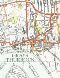
The Value of OS Maps When Hiking

Go out hiking and you’ll invariably see people using Ordnance Survey maps; many will have them open in transparent map cases around their necks. It’s a testament to how good OS maps are that hikers – or anyone who needs to know where they are – will use them; they’re the gold standard. Even in these days of GPS, people still like having an OS map, because it gives a bigger picture of the surroundings and helps people pinpoint where they are – and where they’re going.
Why Do We Need OS Maps?
Maps like the OS Explorers offer the kind of detail hikers need. Once someone learns how to read them – and it’s certainly not rocket science – then it’s quite easy to pinpoint your location without resorting to something fancy, expensive, and liable to breakdown like a GPS receiver. They’re lightweight, easily portable, and in a map case they’re very waterproof.They cover the UK, and they’re constantly being revised (most recently following the Countryside and Rights of Way Act, which has altered the landscape immeasurably for ramblers). The 1:25,000 scale offers plenty of detail, making it very easy to identify landmarks, hills, trails, streams, everything you could need to navigate.
A total of 403 Explorer maps, all easy to identify by their orange covers, map the entire UK, along with the Outdoor Leisure series, which are more aimed at areas of interest, and they can also be bought in laminated versions for those who require that.
They’re really works of great scholarship, and their reliability has made them the bible for all walkers and cyclists – for everyone who uses the outdoors, in fact. For many, even before they venture out, especially to a new area, they’ll pore over the appropriate OS map, gathering data and forming a mental picture of the terrain.
Why You Need An OS Map
These days you can buy a handheld GPS receiver, and they’re certainly good, fitting easily in the pocket. There are even OS applications for smartphones, which can be extremely convenient. But what happens if your battery dies, or you move out of signal range (which is quite possible in wild territory)?That’s never going to happen with a paper map. It will be there for you to consult, and over the years OS maps have certainly saved a number of lives when people have become disorientated on their walks.
When you’re in an area you don’t know well, you should always check the map before you head off, pinpointing where you are, and noting the trail by checking landmarks both visually and on the map. That kind of orientation is vital; every so often, stop and check the map again. If you reach a point where you’re not certain which route to take, consulting the map and then looking at the landscape features around you will offer a guide, just as the map can offer indications of what might be the easiest path to follow, without too many hills.
Used properly, OS maps turn a walk from an expedition into a pleasure, making life much easier. It’s worth amassing a collection for all the places you’re likely to walk. They’re the kind of necessity that’s also an investment.
Business Energy With a Difference
If you are looking for business energy or need advanced solutions like remote energy monitoring, new supplies, downgrading or upgrading capacity, have a no obligation chat with Purely Energy.
To find our more get in touch here. or call 0161 521 3400.


