You may have often, when walking or hiking, noticed a beautiful old church or an old ruined farmhouse in the midst of a field and remarked on how beautiful they look but these sites are not only remnants of the past, they are also important geographical sites that can be used to aid your rescue should you fall into difficulty.
Types of Geographical Sites
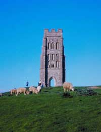
There are many different kinds of sites or buildings that can be used to mark out your location and it is important when you are out walking or hiking that you pay some heed to them. They may well come in very handy in the event of an emergency rescue.
These sites include:
- Churches
- Old outbuildings
- Milestones
- Bridlepaths
- Rivers & Streams
- Unusual Rock Formations
Of course this is not an exhaustive list and depending on the area you are visiting there may be any number of things that could have geographical significance along the way; the trick is to be observant and to make a mental note as you go.
In Case of an Accident
If you - or one of your party - falls injured during a walking or hiking trip and it is impossible for them to make their way back there are a few things you should do before seeking out help.
- Make them comfortable
- Keep them warm
- Establish the nature of the injury
Once you have ensured that these things are being done then you can concentrate on finding help.
Mobile Telephones and GPS
If you have brought a mobile telephone with you - which is always a useful tool to have whilst outdoors - you can try and make contact with the emergency services. If you are in a wide open space then it is likely you will pick up some signal irrespective of how weak it is. This should be enough for you to contact the emergency services and inform them of your location.
Most mobile telephones now come ready equipped with Global Positioning System (GPS) technology which can be used by the Coastguard, air rescue and air ambulances, mountain rescue and other emergency services to pinpoint your position.
If you are in an area which may be hard to navigate for the emergency services then try and give them as much information as you can about the terrain and any hazards you have encountered along the way.
This is where information about geographical sites and landmarks can prove invaluable. You will find in most rescue teams that there are at least one or two locals to the area and passing on information about landmarks will give them a better idea as to your position and should speed up their rescue.
Keep calm throughout and try to keep the injured party - or parties - calm as well. Panicking in an emergency situation can lead to further injury or the giving of incorrect information which can slow down any rescue attempts.
If you are planning such a trip it is important to have the right equipment as well. In saying this do not overload with equipment and supplies but take enough with you to ensure that should you become stranded you have enough to keep you and the other members of your party warm and fed through the night. Also ensure that you have a torch or some other means of providing light in case you are outdoors overnight. The light will also be a useful tool in any rescue party's attempts to find you.


Your email won't be published. Comments are moderated before appearing.